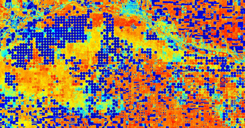
Existen tantos índices espectrales para Sentinel, Landsat o cualquier otro satélite, como bandas disponibles tengas. Cada banda, y cada combinación de ellas puede ayudarte al análisis de aspectos territoriales para el análisis de vegetación, coberturas de nieve, proliferaciones de algas acuáticas o cálculos de niveles de humedad en el terreno. Para que tengas tu lista de índices espectrales ordenada, aquí tienes un repertorio de las bandas de análisis para el cálculo de los indicadores convencionales en los entornos de trabajo de Sentinel y Landsat.

No te olvides que, además de la combinación de bandas mediante álgebra de mapas, también puedes realizar combinaciones RGB de bandas para obtener filtros temáticos que discriminen elementos. Desde esta entrada puedes identificar algunas de las composiciones RGB más habituales en Sentinel y Landsat. Si quieres cononocer cómo se interpretan los colores de una imagen RGB a falso color aquí tienes una sencilla guía para comprender qué elementos son realzados en las composiciones.
Principales índices espectrales para Sentinel y Landsat
Normalized Difference Vegetation Index (NDVI):
NDVI (Landsat 8) = (B5 – B4) / (B5 + B4)
NDVI (Sentinel 2) = (B8 – B4) / (B8 + B4)
Green Normalized Difference Vegetation Index (GNDVI):
GNDVI (Landsat 8) = (B05 – B03) / (B05 + B03)
GNDVI (Sentinel 2) = (B08 – B03) / (B08 + B03)
Enhanced Vegetation Index (EVI):
EVI (Landsat 8) = 2.5 * ((B5 – B4) / ((B5 + 6 * B4 – 7.5 * B2) + 1))
EVI (Sentinel 2) = 2.5 * (B8 – B4) / ((B8 + 6 * B4 – 7.5 * B2) + 1))
Advanced Vegetation Index (AVI):
AVI (Landsat 8) = [B5 * (1 – B4)*(B5 – B4)]1/3
AVI (Sentinel 2) = [B8 * (1 – B4)*(B8 – B4)]1/3
Soil Adjusted Vegetation Index (SAVI):
SAVI (Landsat 8) = ((B5 – B4) / (B5+ B4 + 0,5)) * (1,5)
SAVI (Sentinel 2) = (B08 – B04) / (B08 + B04 + 0,428) * (1,428)
Normalized Difference Moisture Index (NDMI):
NDMI (Landsat 8) = (B5 – B6) / (B5 + B6)
NDMI (Sentinel 2) = (B8 – B11) / (B8 + B11)
Moisture Stress Index (MSI):
MSI (Landsat 8) = B6 / B5
MSI (Sentinel 2) = B11 / B08
Green Coverage Index (GCI):
GCI (Landsat 8) = (B5 / B3) -1
GCI (Sentinel 2) = (B9 / B3) -1
Normalized Burned Ratio Index (NBRI):
NBRI (Landsat 8) = (B5 – B7) / (B5 + B7)
NBRI (Sentinel 2) = (B8 – B12) / (B8 + B12)
Bare Soil Index (BSI):
BSI (Landsta 8) = (B6 + B4) – (B5 + B2) / (B6 + B4) + (B5 + B2)
BSI (Sentinel 2) = (B11 + B4) – (B8 + B2) / (B11 + B4) + (B8 + B2)
Normalized Difference Water Index (NDWI):
NDWI (Landsat 8) = (B3 – B5) / (B3 + B5)
NDWI (Sentinel 2) = (B3 – B8) / (B3 + B8)
Normalized Difference Snow Index (NDSI):
NDSI (Landsat 8) = (B3 – B6) / (B3 + B6)
NDSI (Sentinel 2) = (B3 – B11) / (B3 + B11)
Normalized Difference Glacier Index (NDGI):
NDWI (Landsat 8) = (B3 – B4) / (B3 + B4)
NDWI (Sentinel 2) = (B3 – B4) / (B3 + B4)


